|
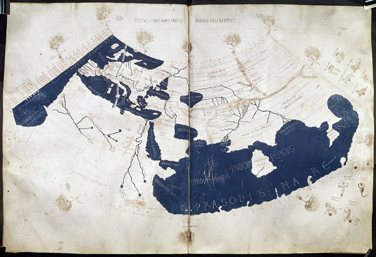
When scholars plot Ptolemy's coordinates for Britain and Ireland directly onto a modern map, the results are visibly wrong. Ireland appears slightly offset. Southern England shows a larger distortion. Scotland appears rotated by roughly 90 degrees.
The conventional assumption has been that Ptolemy simply made mistakes — that his data was imprecise, his sources unreliable. Previous analyses by Bill Thayer (LacusCurtius) and by Darcy and Flynn (2008) both concluded that direct plotting of the coordinates was not particularly productive.
This site takes a different approach.
Simon's hypothesis: The latitude and longitude values in the Geographia are not true absolute coordinates. Instead, they are calculated relative to a small number of fixed, known reference points — most likely including Roman Gades (modern Cadiz) in southern Spain, Wexford in Ireland, and Colchester and Burgh Castle in Britain. Once this is understood, the distortions can be explained and the locations of unidentified settlements mapped with reasonable confidence.
This approach has allowed a number of Ptolemy's unidentified locations — including inland towns, river mouths and tribal territories — to be plotted onto modern maps for the first time.
| ;)