|
 | Anglo Saxon History |  | |
| | Roman Roads in Britain |
|---|
In the 1960's a Sussex historian named Ivan D Margary mapped or collated a collection of the details of a large number
of Roman roads across the UK, his book was based on an earlier book by Thomas Codrington from 1903.
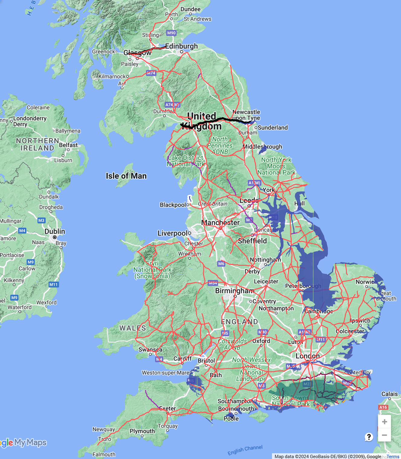
The maps shown below were built using 'Google My Maps' and are based on the details from the two books set
'Roman Roads in Britain' from these maps we have taken snapshots.
Hadrian's Wall and the northern Antonine Walls are shown as black lines.
The red lines show known Roman Roads as defined by Ivan D Margary in 1963.
The large green area in the South of England shows the Forest of Anderida, please see our Andredsweald pages.
The blue areas show the land under 4.5 metres which we have identified as the shoreline in Roman times.
The red lines show fairly accurately the routes of Margary's Roman Roads, but the names of places have changed since
the book was written, so there are a few inaccuracies.
The magenta lines show the routes of Roman Ridgeways in the South East.
Purple lines show likely roman roads as described by Margary.
|
|
|---|

|
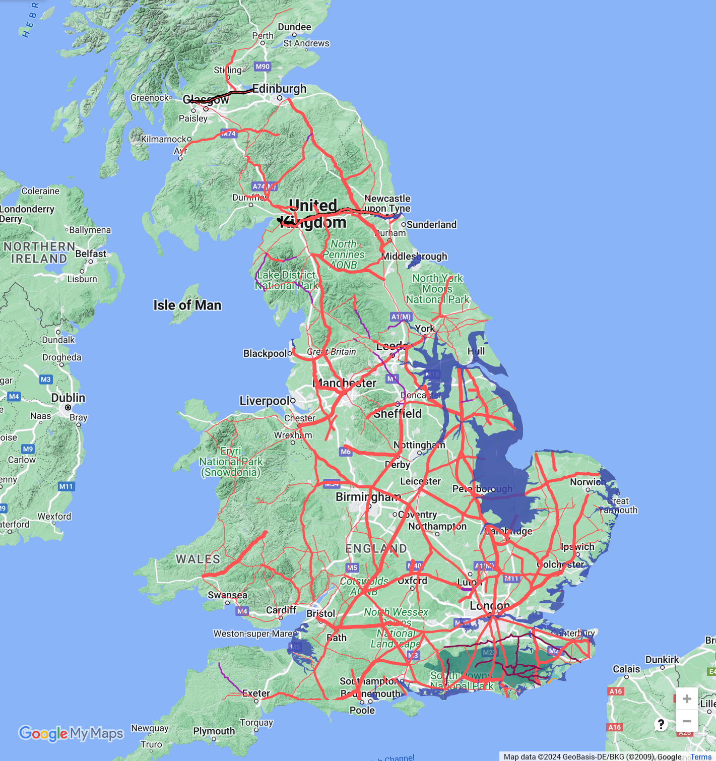
The next map shows the roads with their relative widths shown, showing the major routes similar to our modern
Ordnance Survey maps.
This map shows roads in four different scales, the widest lines show roads over 40ft wide, the next step down shows
roads between 30 and 39ft wide, then the 20 to 29ft wide roads, and finally the smallest showing roads less than 20 ft
wide or roads where we have no width data.
As you can see there are major routes from the ports on the South Coast in towards London, Silchester and Bath, then up
into the Midlands from Bath and London to Lincoln, and finally up to Hadrians Wall and the Antonine Wall in Scotland.
From a purely military perspective it would seem likely that there was a road between Salisbury and Bath, and a further
wide road from Winchester towards Pevensey.
Quite a few roads stop as far as Margary was concerned, but with the advances in Google maps there appear to be routes
that these could follow, but we have stuck to the original document for this map.
| | |
|---|
|
|---|

|
|
|
|
|
| |
|
|
Local Interest
Just click an image |
|
|
|
|
|
|
|
|
|
|
|
|
| |
|
|