|
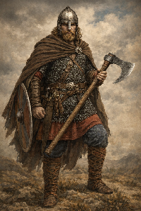
Saxon viking axe | Anglo Saxon History

Search Pages |  | |
| Anglo Saxon Chronicles - 455AD - Aeglesthrep
(Henghest and Horsa) |
|---|
| | What does this mean |
|---|
If we look at the Saxon name 'Agælesþreáp', pronounced 'Eagles threp' it is made up from two Saxon components 'Agæles' which means 'Eagles' and 'þreáp' which means 'troops'.
This would make this location the 'Place of the Eagle troops - Roman Legion', the most likely place for this is the old Roman Legion fort at Rochester.
Rochester
This is derived from the Saxon 'Hrof' - roofed
and 'cæster' - a roman fortified town - hence 'the Roofed Roman Fort'
The walled area of Rochester is about the size required for a complete Roman Legion. Rochester was known as 'Durobrivae' by the Romans and is a main stopping point on Watling Street where the Medway was bridged.
Rochester was also the second administrative centre for the Cantii and administered West Kent from the Medway to London, so would be a good place for Vortigern to be based if pushed out of Canterbury which was the main administrative center of the Cantii and usually controlled the Eastern part of Kent.
In the 1800's this battle was claimed to be at nearby 'Aylesford' as the name was similar, but the strategic importance of the bridge at Rochester would have been more important than the ford at Aylesford.
| | |
|---|
| Possible interpretation of the Chronicles |
|---|
If Vortigern had been pushed back from Canterbury by Henghest and Horsa then this would be a good place to defend based in the old Roman Fortress at Rochester and blocking Watling Street to London by holding the bridge across the Medway.
| 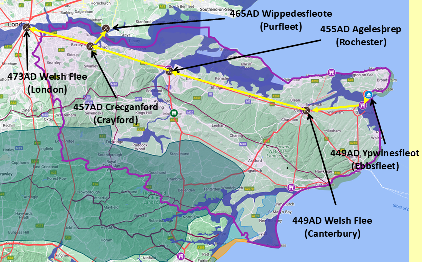
Map generated using Google My Maps 2024 - showing the Landscape, modern Counties and sea in 455AD
Please Note: this map is my interpretation of the Anglo Saxon Chronicles entries relating to Henghest, Horsa and Aesc and their take over of Kent, the purple line shows the modern Kent boundary.
The logic for the coastal changes and the Forest of Andredsweald can be viewed on the following pages:
Roman Roads in Britain
The Great Forest of Andredsweald - Anglo Saxon Chronicles
Landscape - Was the sea level in Saxon times at Pevensey 4 to 5 metres higher ?
Was the high tide in Saxon times 5 metres higher ? - the Wash
Landscape - The History of the Romney Marsh in maps
Roman Locations that have not been identified and roads that just terminate
|
|
|
|
|
| |
|
|
Local Interest
Just click an image |
|
|
|
|
|
|
|
|
|
|
|
|
| |
|
|
;)