|
 | Anglo Saxon History |  | |
| | Battle of Hastings 1066AD - N - The Hoar Apple Tree |
|---|
| | Table of Contents |
|---|
| | |
|---|
Current understanding ▲
|
|---|
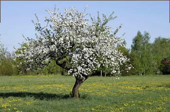
 The current understanding is that King Harold sent messages to the various Saxon regions to muster the forces at the
hoar(old) apple tree which was on Senlac Hill in the town of Battle.
Please take look at the details below and see if the above sentence makes sense and what conclusions you come to, my
comments are at the bottom.
| | |
|---|
Documentary Evidence ▲
|
|---|
The only document mentioning the tree is the Anglo Saxon Chronicles.
There are currently 6 different versions of the Anglo Saxon Chronicles, so lets see what each one says for AD1066.
'The Parker Chronicle' doesn't mention a tree
'Cotton Tiberius A.vi' has no entry for 1066
'Cotton Tiberius C.i' doesn't mention a tree
'Cotton Tiberius B.iv' in Anglo Saxon
Þis wearð þa Harolde cynge gecydd,
he gaderade þa mycelne here,
com him togenes æt þære haran apuldran,
Wyllelm him com ongean on unwær, ær þis folc gefylced wære.
This is the original translation by the Reverend James Ingram (London, 1823)
This was then told to King Harold;
and he gathered a large force,
and came to meet him at the estuary of Appledore.(this would read apuldre ora in Anglo Saxon)
William, however, came against him unawares, ere his army was
collected;
The common translation of
'com him togenes æt þære haran apuldran'
is Harold ‘came to meet him [William] at the hoar (or grey) apple-tree.’
our translation of the same phrase using Bosworth Toller Anglo Saxon Dictionary.
came him together at there 'hare or hairy' apple trees
so rephrased to 'they met him at the orchard where the hares run' or ' they met him at the hairy orchard'
'Bodleian MS Laud 636' doesn't mention a tree
'Cotton Domitian A.ix' has no entry for 1066
|
Translation issues ▲
|
|---|
The confusion is around the translation of both haran and apuldran
Haran
'hara' in Anglo Saxon means hare as in the long eared rabbit.
'haran' doesn't exist by itself but is used to describe multiples, as in 'haran hige' meaning 'hares foot' the plant
and in 'haran-wyrt' meaning 'hare wort'
'hǽren' in Anglo Saxon means 'made of hair' (possibly describing litchen)
'har' in Anglo Saxon means 'Hoar, hoary, grey'
There is a Anglo Saxon suffix –en which means people of or subjects of, and is used in Saxon village names.
So the various valid options are hare,hairy,hoar,hoary or grey
apuldran
'apuldre' meaning apple tree, or possibly fruit tree
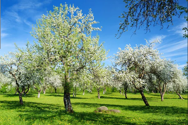
'apuldran' possibly meaning multiple trees as in an orchard
So the various valid options are apple tree, fruit tree or orchard
So this gives us the probably meanings of the 'old orchard', the 'hairy orchard' or the 'orchard where the hares
are'.
So as you can see there are a number of possible translations
| | |
|---|
An Old Orchard ▲
|
|---|

| | |
|---|
| Conclusion ▲ |
|---|
If the place recorded as the 'Haran alpuldran' actually existed then:
- The location must have been fairly well known to the Saxons so the Fyrð from all the counties could muster
there.
- It must have been at a point on a major route probably on an old Roman road at a major junction or in a large town
or city.
- It must also have been some way inland as most invasions would have come from the coast and having your troops meet
up close to the enemy could be disastrous.
- So this gives us the probable meanings of the 'the old orchard', the 'hairy orchard' or the one I
believe is the most likely translation is the 'orchard where the hares live' or The people of the old
orchard.
This would imply that the Saxons had a number of pre-set easy to find locations across the country where the
individual Fyrð and the Huscarls and the King could join up. This would mean that the local Fyrð would go to their
nearest town, then the town would go to the nearest main city, then they would march to a nearby point where they would
finally muster.
There is only one reference to the 'Hoar Apple tree' and that exists only in one of the six
versions of the Anglo Saxon Chronicles so has limited documentary evidence. However the Fyrð would need to have
locations to combine with the King's forces so this is likely to be a real place.
It is most unlikely that the muster point was at the hoar(old) apple tree on Senlac Hill in the town of Battle, if it
even existed.
From a strategic perspective Battle is too near Hastings to muster. If the Fyrð arrived there to muster in small
units, Williams troops could have easily seen them arrive and destroyed these individual units without needing to fight
Harold's combined forces.
So the muster point has to be located on a road through the Forest(because of the number of troops)
and far enough away from Hastings to prevent the Normans destroying the individual units as they arrive.
|
The landscape at 1066AD ▲
|
|---|
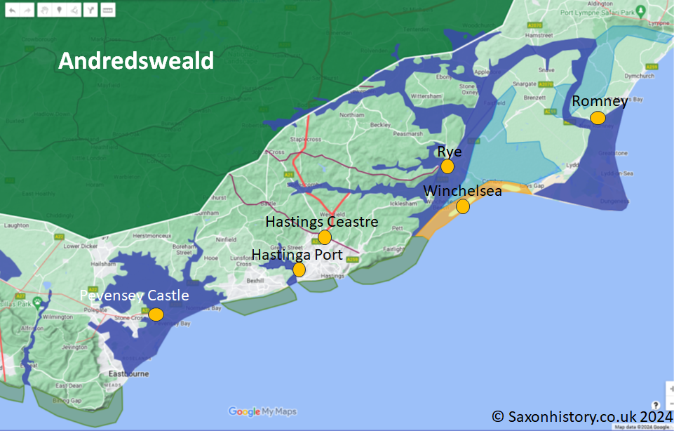
 The green shaded area shows The Great
Forest of Andredsweald - Anglo Saxon Chronicles, the red lines are known Roman roads and the maroon lines show the
old Celtic Ridgeways as defined by Ivan D Margary. The castles symbols show positions of the old Roman fort at Pevensey
and the Burghal Hideage fort at Hastings(Landscape -
Alfred the Greats fort in Hastings).
The Eastern Rother, Brede and Tillingham rivers combine and reach the sea at New Romney on the Romney Marsh(Landscape - The History of
the Romney Marsh in maps).
| | |
|---|
Another Interesting Article ▲
|
|---|
Regarding the possible location of the hoar apple tree the following link created by a collegue may be of interest Horeappletree
and Horeappletree Common which gives an interesting idea for a location near Broad Oak(Heathfield), which I believe
would be a logical muster site for Harold's troops.
This location would have been inside the Forest of Andredsweald but was most likely heathland so was open and suitable
for camping, it was also on the Crowborough to Hastings ancient ridgeway which leads to Battle town, and was far enough
away from the coast to allow small local units of Fyrð to meet up and join up to make an army, so a possibility for a
muster point.
It can also be reached from Gravesend by going down the old Roman Road to Benenden, or from Ashford to Benenden, then
down towards Bodiam across to Etchingham and then across the Rother to the ridgeway from Etchingham to Broad Oak.
|
|
|
|
|
|
| |
|
|
Local Interest
Just click an image |
|
|
|
|
|
|
|
|
|
|
|
|
| |
|
|