Saxon Seaxe Anglo Saxon History
saxonhistory.co.uk
Map Position
This map shows the position of locations containing '1066, anderida' centered on Battle in Sussex.
Map Logic
This map shows Roman roads shown in black plotted from Ivan D Margary 'Roman Roads in Britain' published in 1955.

The red roads are taken from Ivan D Margary 'Roman ways in the Weald' published in 1948.

Also shown is the border of the Forest of Anderida in green. The changes in the coastline shown in pale blue, and the 5 metre high tide mark on the rivers shown in dark blue.

Please Note: the modern roads shown are very unlikely to be have been of use in 1066 as the majority of modern roads cross clay filled valleys. so we will only concern ourselves with old Roman roads or Ridgeways.
 
Icon Key:
Town
Ships
Norman Fort
Earthworks
Battle Site

Battle of Hastings - Warriors and Weapons
Huscarl(Housecarl)


The Huscarl's(also known as Housecarl) were the paid warriors that were the core of the Saxon Military system, the payments they received for their service could either be in gold or in land..


https://spearsofandred.com
The Huscarls were the Kings or Eorl's(modern Earl) guards and were highly trained, the name is a norse term húscarl meaning house man, but at this time was used as a term for bodyguard.

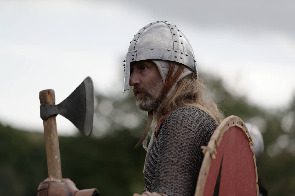
Generally they were well armed with the long handled axe and sword and protected by chain mail, iron helmets and shields.

They rode to battle on horseback but dismounted to fight with their axe's, and when the battle came too close would revert to shield and sword.
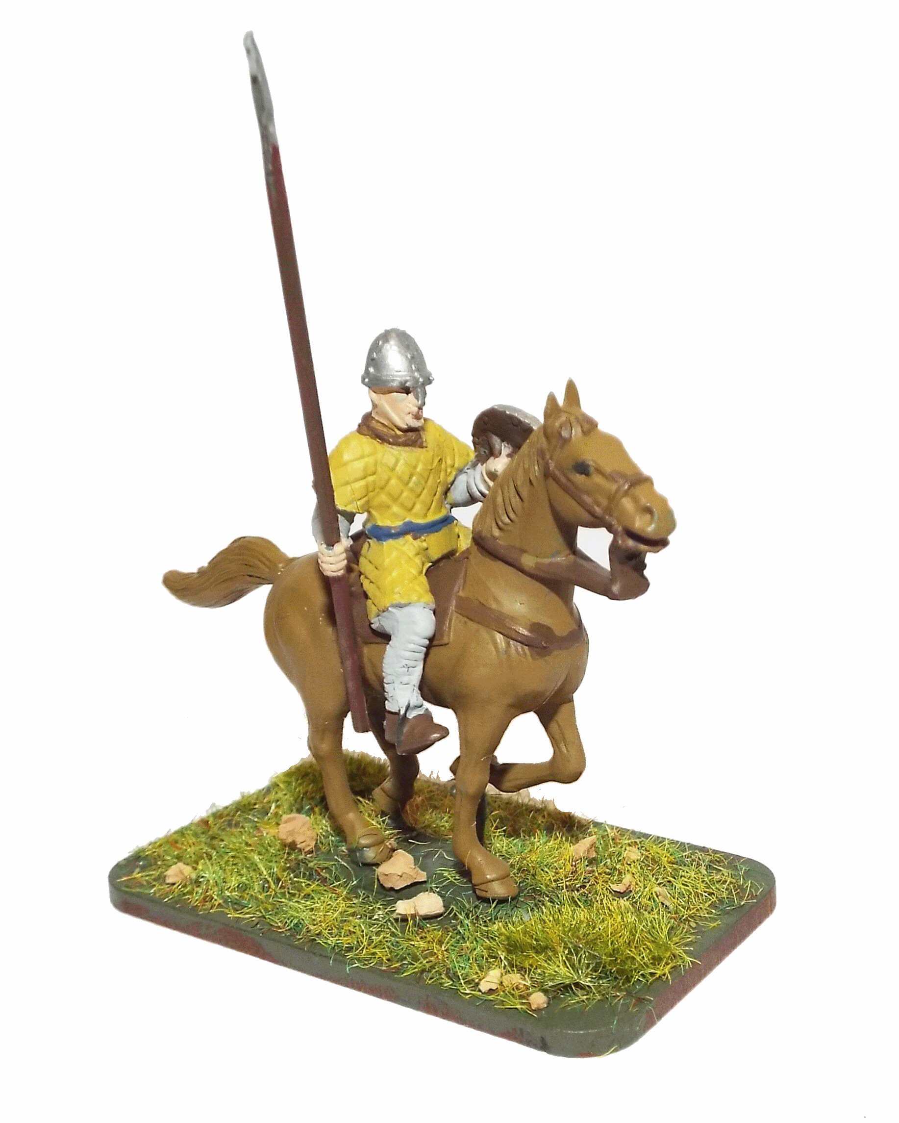
In this photo to the right the Huscarl is wearing an early chain mail tunic generally described as a corselet, but the later manufactured chain mail was worn down to the knees to protect the upper leg The Huscarls would have used either form depending on their wealth and personal preferences.

Their shields could either be the early rounded wooden shield, or the kite shaped one that the Normans designed for protecting their horsemen's left side while their weapons were used in the right hand. The Huscarls tended to attach their shields to their backs to protect themselves when using their two handed axe, as this would have been a very vulnerable area and a kite shaped shield would have protected more of their body.

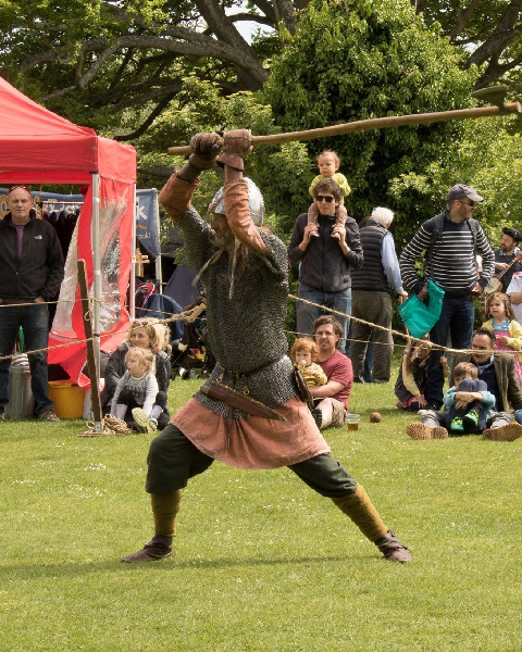
The long handled axes also known as Dane Axes were reported to have been capable of cutting off both men and horses heads, and of cleaving helmets and chain mail, but were light enough to have been held one handed for close fighting.

These fighting axes weighed about 1.5Kg(3lb) and were about 1.8 metres(6 ft) long, so were extremely effective weapons if there was space around a wielder. In close quarters these axes would have been less useful so the Huscarls would have used swords.

https://spearsofandred.com

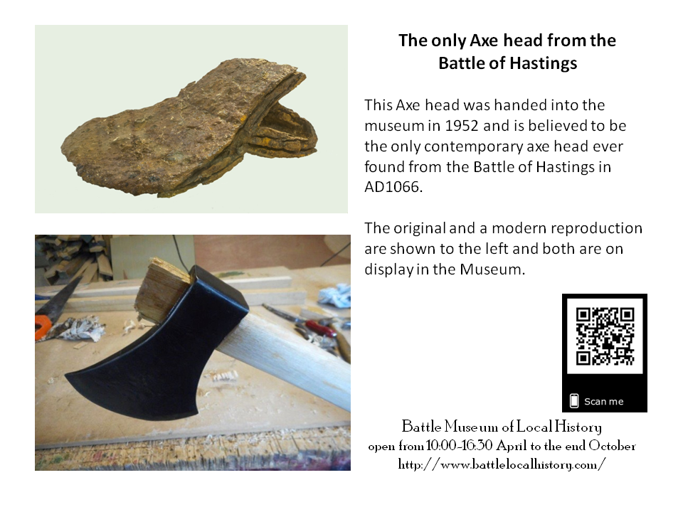
A contemporary axe possibly from the Battle together with a modern reproduction can be seen at 'Battle Museum' in Battle High Street - please check the opening times before visiting.

An account from the battle of Stamford Bridge gives you some idea of its effectiveness in the right hands:-
Here a single Norwegian, whose name ought to have been preserved, took post on a bridge, and hewing down more than forty of the English with a battleaxe, his country's weapon, stayed the advance of the whole English army till the ninth horn


The bayeux tapestry appears to show Huscarls wielding their axes from the left to hit the unshielded sides of the Norman horsemen.


http://battlelocalhistory.com
Battle Museum of Local History has the only example of a contemporary battle axe head in the UK.

They also have a modern reproduction of the axe, together with video's showing its manufacture using smithing skills from the period, and how it was used in warfare.

If you click on the picture a pop up window showing the museum web site will be opened.

The Museum is open to the public from April to the end of October from 10:00 until 16:30 Monday to Saturday


External References in no particular order :-
Anglo Saxon Chronicles
Online Anglo Saxon dictionary
Online Etymology dictionary
Open Domesday Book - The first free online copy of the Domesday Book
The Ermine Street Guard Roman re-enactment and research Society
The "Kent A" cadastre - page 5 - Peterson 2002
Archaeologia Cantiana Online
Romney Marsh Research Trust
Romney Marsh the Fifth Continent
VillageNet the reference guide to villages in Kent & Sussex
Global warming Flood Maps
The Anglo Saxon Chronicles
Google Maps - the core of the system
GeoPlaner - Useful site for plotting map data
Julius Caesar's Gallic Wars 55BC(Books 4 & 5)
Wikipedia - Caesar's invasions of Britain
Wikipedia - Portus Istus
The Geography of Claudius Ptolemy (Bill Thayers)
Roman Britain.org
Runetree Beowulf
Bayeux Tapestry Online
The Secrets of the Norman Invasion
Chronicles of John of Worcester
Battle Historic Society
Binsted village website(Mearcredesburnan Steðe)
The Spears of Andred
Find British Archaelogical Sites
Wealden Iron Research Group
Topographic Map of the UK


Copyright saxonhistory.co.uk 2013 - 2024
Contact me
Author: Simon M - Last Updated: 13/03/2024 13:12All pages on our site (Sitemap)Data is derived from a number or sources including the Ordnance Survey Gazetter data overlayed onto Google Maps