| Anglo Saxon Chronicles - 514AD - Stuff and Wihtgar |
|---|
| The entry from the Chronicles |
|---|
Original text
Her cuomon Westseaxe in Bretene mid .iii. scipum in þa stowe þe is gecueden Cerdicesora, ⁊ Stuf ⁊ Wihtgar, ⁊ fuhton wiþ Brettas ⁊ hie gefliemdon.
Translation
514AD. This year came the West-Saxons into Britain, with three ships, at the place that is called Cerdic's-ore. And Stuff and Wihtgar fought with the Britons, and put them to flight.
| An Interpretation of the Chronicles |
|---|
Stuff and Whitgar land at Cerdicesora (Itchenor) with three ships so probably only have about 60 men.
They fight the Welsh sometime later during 514AD.
We know that in 530AD Cerdic and Cynric took Wihtgarabyrg which consists of three snippets 'Wiht' named after the isle of Wight 'gara' which means 'a corner of land' and 'byrg' a burh 'a castle', hence 'the castle on the edge of the hills on the Isle of Wight' (probably Carisbrook) and later in 534AD they gave the whole of the Isle of Wight to Stuff and Whitgar.
This implies that Stuff and Whitgar had already landed on the island, but had not been able to take the whole island.
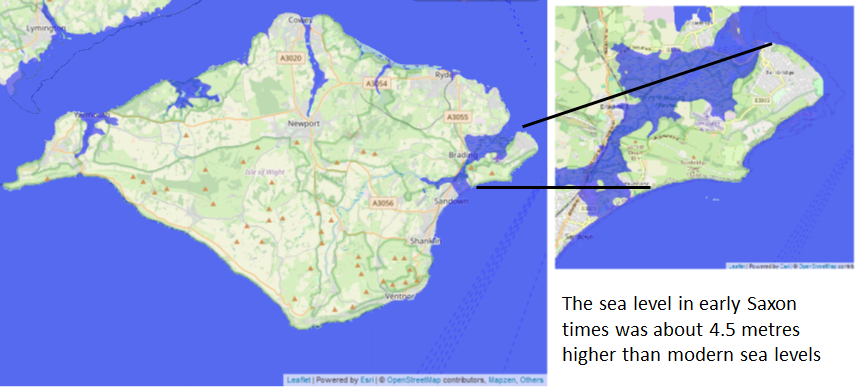
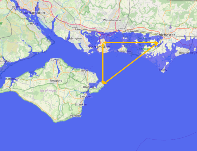
If they landed on the island, there is only one place they could have landed which would have been defendable by their small force and that is the area around Bembridge which was an island at the time, and would make a good small kingdom. Bembridge translates from the two Saxon snippets 'Bem' from 'bán' meaning 'bones' and 'bridge' meaning a bridge, hence 'the bridge of bones', possibly a battle site, this island would have had easy trade routes back to Port and Portsmouth and to Cerdic and Cynric at Itchenor.
There is also coincidentally an area on Bembridge island called Ethel point, this can be translated from the Saxon 'eþel' pronounced Ethyl and means 'Fatherland', 'point' is a later Norman addition, so this could help in the above interpretation.
'Binbridge Isle' is published on John Speeds map of the Isle of Wight from 1611, and although not quite an island on the map it shows most of the boundary of the island.
Please see our article ~~Sea_levels_and_the_Pevensey_islands~~ that explains the high tide levels in Early Saxon times and ~~Sea_Level_Rises~~
| Possible landing place of Stuff and Whitgar |
|---|
| | |
|---|
Possible trade routes between Stuff and Whitgar, Port and Cerdic |
|---|
| | |
|---|
Map showing the Battles of Cerdic, Cynric and the West Saxons |
|---|
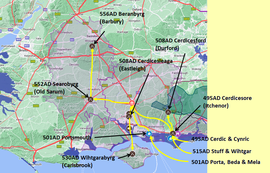
Map generated using Google My Maps 2024 - showing the Landscape, modern Counties and sea in 477AD
Please Note: this map is my interpretation of the Anglo Saxon Chronicles entries relating to Cerdic, Cynric and the West Saxons and their take over of Hampshire, the thin purple line shows the modern Hampshire boundary.
The logic for the coastal changes and the Forest of Andredsweald can be viewed on the following pages:
Roman Roads in Britain
Anglo Saxon Chronicles - 892AD - The Great Oak Forest of Andredsweald
Landscape - Was the high tide level in Saxon times at Pevensey at about 4.5 metres ?
Landscape - Was the high tide level in Saxon times in the Wash 4 to 5 metres higher ?
Landscape - The History of the Romney Marsh in maps
Roman Locations that have not been identified and roads that just terminate
| | |
|---|
Conclusion |
|---|
The majority of this article is conjecture, but it does seem to fit the history and the landscape, but hopefully this has given you a different view of the Anglo Saxon Chronicles.
|
|
|
;)


