The black lines show the routes of old Roman main roads, the red lines show ancient ridgeways mostly running
east to west, both of these major route types were likely to still be in use in 1066, as they would be the only way
a large force of men could move by foot through the Forest of Andredsweald to Hastings.
The sea is shown at aproximately the 5 metre contour line, as it would seem that this was the high tide mark which
I believe we can explain in our High Tide Changes Page. The course of the Rother through
the Romney Marsh is explained on our Romney Marsh 1000AD page, with
other points in time recorded on our other Romney Marsh pages.
The Green shaded area represents the Forest of Andredsweald which has been plotted using the location of
Domesday villages, this also corroborates with the plot of
modern villages containing Hurst the majority of which have appeared after the
Battle of Hastings.
(So I think this is a reasonable plot of Andredsweald).
The Area out to sea to the East of Hastings has been calculated to the current erosion rates of about 0.8 metre
per year for the sandstone cliffs at Fairlight. The area to the West of Eastbourne has also been caculated at an
erosion rate of about 0.9 metre per year for the chalk cliffs at Beachy Head.
 |  |
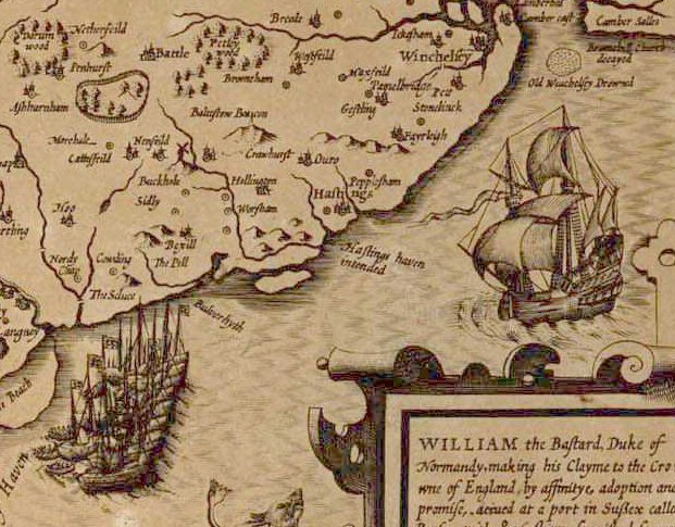
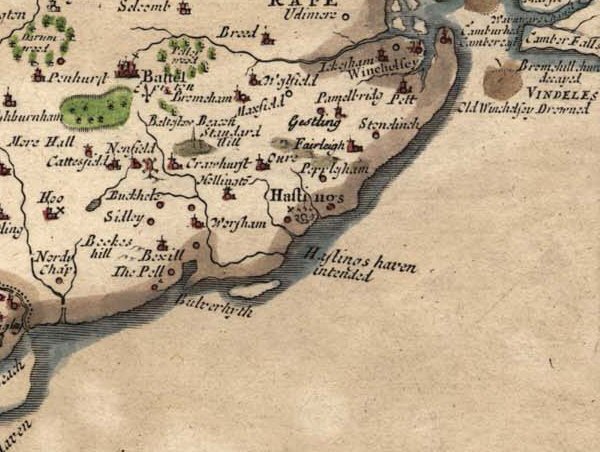
| John Speed's Sussex AD1610 | Robert Morden's Sussex AD1695 |
|---|
| Please click on the maps to be taken to Sussex Record Society
large size and complete maps. |
The area off the coast of Bexhill is conjecture based on the 'John Speed map of Sussex from 1610 and Robert Morden
map of Sussex from 1695' both of which which shows an island off the coast of Hastings which together with the
overall direction of ridges in the area running west to east, implies that the Combe Valley originally reached
the sea at Hastings. When the great storm of 1287AD hit the South Coast it eroded the cliff at Hastings where it is
recorded some of the Castle collapsed into the sea, this rockfall could have blocked the entrance to the Coombe Valley
with the river then breaking through directly to the sea at present day Bulverhythe. This in turn would have
created an island off the coast of Hastings which is shown in the old maps, with subsequent erosion removing it from
modern maps.
|