Lets take an area I don't really know, the Wash and see if the Pevensey arguement applies- click here if you would like to see a similar argument applied to an area I do know, the Pevensey Levels in Sussex.
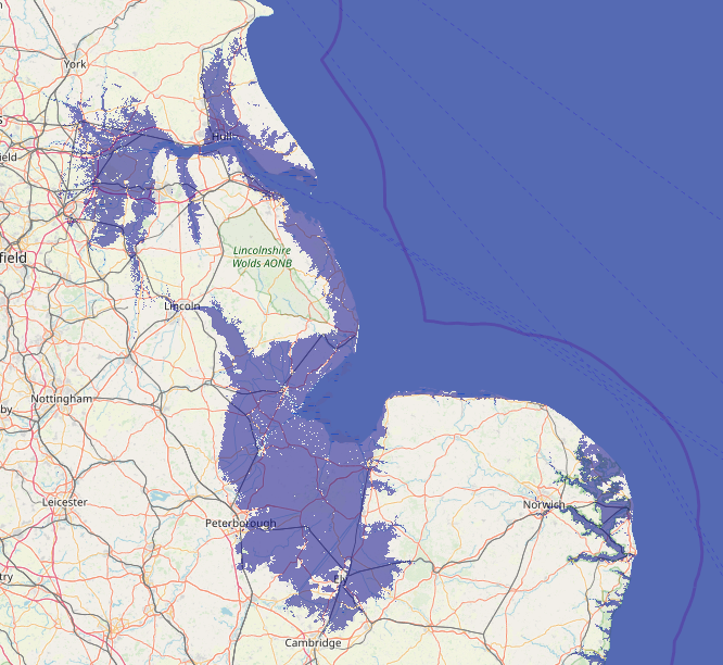
I think this is a valid argument for a 5 metre sea level so we need to overlay all our maps with this and see what this shows, the
map at the top of the page shows what effect this would have on the Wash. As you will see on the top map, most
of the river valleys would have been accessible from the sea, a large areas would have been.
The 'Time Team' carried out a dig at 'Bawsey st Peter' in Norfolk and found a causeway to the island there, this also ties
in with the increase in high tide level by about 5 metres, the Saxon name Bawsey either means 'Pasture Island' or 'Boars Island'
so more evidence that the 5 metre mark is valid.
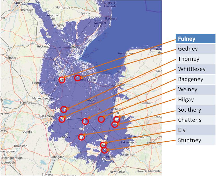
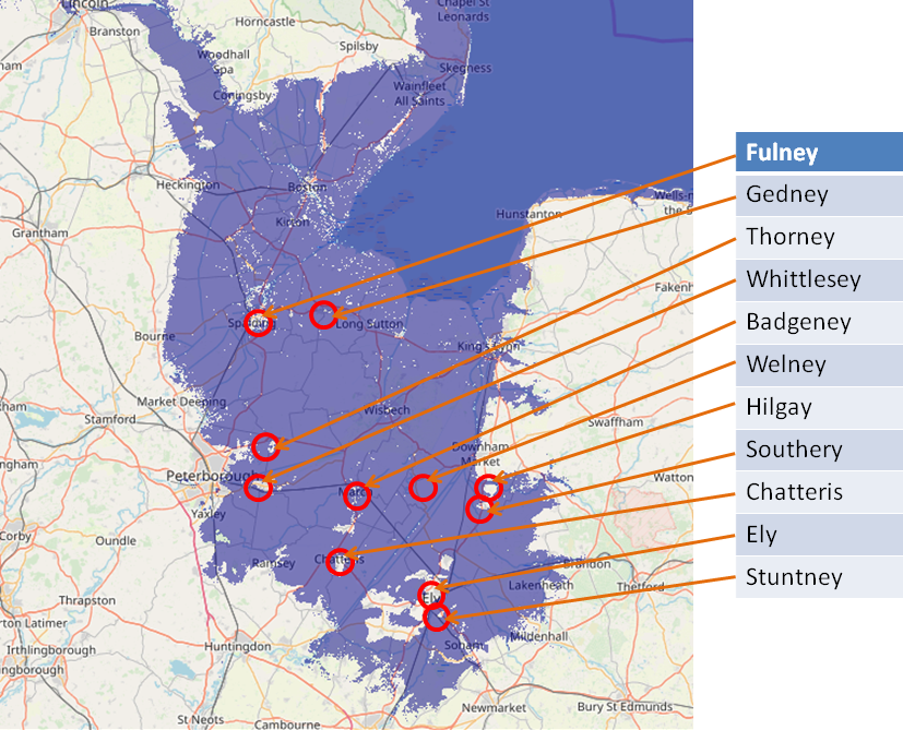
The following images are derived from Open Streetmap with the sea level overlays provided by Alex Tingle from http://flood.firetree.net, please note that you can click on each map below to show the flood.firetree map.
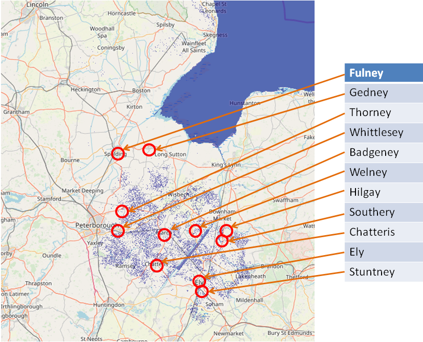
The map above shows the current sea level, as you can see very few of the locations whose name implies an island are actually islands, but the area near Ely is at sea level.
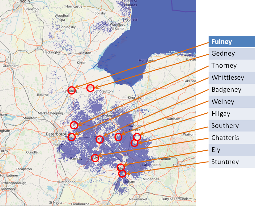
This map shows what the land would look like if the Sea Level rose by 1 metre, Ely is still land based.
This map shows what the land would look like if the Sea Level rose by 2 metres, the area around Ely is starting to look more like an island.
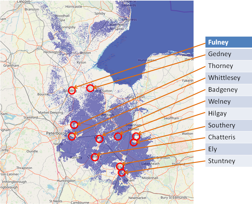
This map shows what the land would look like if the Sea Level rose by 3 metres, Ely is just an island, but some of the others are still not islands.
This map shows what the land would look like if the Sea Level rose by 4 metres, this is much better but still the area near Spalding
is still not there yet.
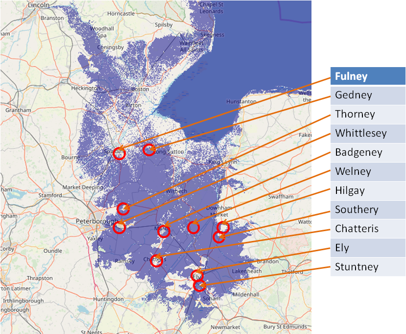
This map shows what the land would look like if the Sea Level rose by 5 metres, all the locations now look like islands, so this again implies that the high tide level was at the 5 metre mark in early Saxon times..
The University of Durham Archaeological Department has suggested a similar sea level rise in the Wash in late Roman times based on sediment
analysis (early Saxon). �and indeed calculations for Spalding based on estimates of highest tides suggest a maximum rise of 4.22m, echoed
by 4.52m on the Fen Causeway between Peterborough and Denver in Roman times.�
https://www.dur.ac.uk/east-lincs-history
I think the above information provides a valid argument for a 4-5 metre sea level rise in early Saxon times compared to today,
this could be actual rises or that the modern sea defenses are blocking this rise. So the whole area around the Wash, Norfolk and
Lincolnshire would have looked similar to the map shown below, please note we are not showing the land that has been eroded from the
coastline, which in the case of Norfolk has been be a few metres per year.
|


