| Battle of Hastings 1066AD - W - The Battlefield Location |
|---|
|
- ▼ Introduction
- ▼ Why are alternate sites continuously being suggested
- ▼ The sites that have been proposed as at Dec 2025
- ▼ Website and Book links for the Battlefield sites
- ▼ Chronicle snippets that describe the landscape around the Battle
- ▼ Landscape Features affecting the Site of the Battle
- ▼ 1. The Haran Apuldran (Hoar Apple tree ?? ASC)
- ▼ 2. The Saxons were near a forest (CAR,BT)
- ▼ 3. Harold ascended a hill (CAR)
- ▼ 4. The Saxons were on a hill (CAR,BAC,MW,BT)
- ▼ 5. The Saxons were on a level ground (HH)
- ▼ 6. The Saxons fortify their position (OV,MW,HH,FW,BA,BT)
- ▼ 7. The terrain was rugged and uncultivated (BT,CAR)
- ▼ 8. The area was called Senlac (OV)
- ▼ 9. The Battlefield was quite wide and not restricted (MW)
- ▼ 10. The Battle was 9 miles from Hastings (FW)
- ▼ 11. The Norman camp was at the seaside (CAR)
- ▼ 12. The Battle raged from the 3rd Hour (FW,OV)
- ▼ 13. William was initially on a hill (BAC,MW)
- ▼ 14. The hill William was on was called Hecheland (BAC)
- ▼ 15. The Normans advanced over a ridge (MW)
- ▼ 16. Behind the Normans was another hill (MW)
- ▼ 17. There was a fosse between the forces (MW, HH, FW)
- ▼ 18. There was a steep slope up to the Saxons (CAR)
- ▼ 19. Behind the Saxons was another hill (MW)
- ▼ 20. The sea was behind the Normans (CAR)
- ▼ 21. Fleeing Saxons were killed when a bridge collapsed (MW)
- ▼ Landscape Features affecting the Site of the Battle - Summary
- ▼ Battle times from the Chronicles
- ▼ Sunrise and Sunset times in October 1066AD
- ▼ Map showing possible distances from the Normans coastal base
|
| Introduction ▲ |
|---|
Where exactly was the Battle of Hastings fought?
The answer most people know — on the ridge where Battle Abbey now stands — rests almost entirely on the word of the monks who built the Abbey and had every reason to place the battlefield directly beneath their foundations. The physical evidence tells a different story: after more than a century of searching, only one artifact has been found anywhere in the area that might date to the battle, and its provenance is unknown.
This page takes a systematic approach to the question. Rather than starting from the Abbey and working backwards, it assembles every landscape clue from across all the major chronicles — 21 features in total, from the height and width of the hill to the distance from Hastings, the presence of a forest, a fosse, a steep slope, a ridge behind the Normans, and a bridge that collapsed during the retreat — and asks which of the twelve proposed alternative sites satisfies the most of them. The result is a genuinely open analysis of one of the most contested questions in English history, with a map showing how march distances from the Norman coastal base constrain the possible locations to a surprisingly specific corridor.
| | |
|---|
Why are alternate sites continuously being suggested ▲ |
|---|
The biggest problem that the story of 'The Battle of Hastings' has is that there is no or very limited physical evidence for a Battle anywhere in the Hastings area.
At the moment there is only one piece of physical evidence dated to the period that has been found in the area, this can be found in Battle Museum and is an axe head dated to the period by an arms expert from one of the London Museums. The axe head can't be carbon dated as it was covered in varnish from the 1950's.
This axe head is the right size for a Battleaxe, however as the Great Oak forest of Andredsweald was in the area, its possibly an axe used for felling oak trees, as these were a similar size and shape in this period.
The axe was donated to the Museum in 1953 and the owners lived in an area of Battle called Marley Lane, however there are no details if this was found there or if it belonged to a relative who lived in the area.
So we have one artifact and no provenance, this is where the alternative sites ideas are derived from.
The 'Time Team' from the Channel 5 TV company came to Battle Abbey in 2003 to discover evidence for the Battle on the claimed Battlefield, which is on a slope to the South East of the Abbey. You can see this episode on the following link 1066 - The Lost Battlefield | Time Team Classic Special (Full Episode) , where they found no evidence, but suggested that the Battle may have been fought eastwards towards Battle Hill on the A2100.
This now has provided a number of sites proposed by various local people who believe the Abbey was built in a convenient place as it is on the main ridgeway out of Hastings, has fresh water and a nearby quarry for stone.
So I will now bring you the various sites that have been proposed, these are on separate pages on the site as one page on all the proposed sites would be difficult to navigate through.
I will try to be analytical in my view, but may be a bit biased in my view on one of the sites but will let you know which one it is.
| The sites that have been proposed as at Dec 2025 ▲ |
|---|
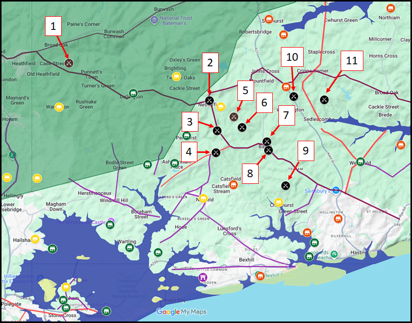
The map above shows the area with the high tides marked in blue, as you can see the area is a peninsular and the way out on land is via Heathfield or Bodiam. Red villages are those marked as destroyed in Domesday, Yellow are marked as damaged and the Green ones are those marked as undamaged settlements. The Forest of Andredsweald is shown as a green shaded area.
| Website and Book links for the Battlefield sites ▲ |
|---|
Please note these are not in any specific order.
- 1. The Hoar Apple Tree
- 2. Netherfield
-
This is suggested by Simon Mansfield and is based on the landscape around the junction of the Battle Road(B2096) and the Netherfield road at Darvel Down.
- 3. Creep Wood
-
This one is based on a book by Kathleen Richardson - 'The Mystery of Town Creep', and is predicated on the fact that Town Creep is claimed to be an old Roman fort.
.
- 4. Normanhurst
-
This location has no one person suggesting it, but is based on the locally held legend that Standard Hill at Ninfield was where William had his flag, and this is the next ridge in the area
.
- 5. Ashes Wood
-
This location is suggested by Kevin Casey in his blog.
- 6. Beech Farm Hill
-
This location was originally suggested by Simon Coleman but he has now rejected this site and '1. The Hoar Apple Tree' location has superceeded this site
.
- 7. Caldbec Hill
- 8. Battle Abbey
- 9. Crowhurst
- 10. Whatlington
-
This location is proposed by Fred Waghorn, but to be fair it is a location for the last battle of the Saxons at the Malfosse which is near a proposed hillfort at the White Chapel in Whatlington, this was published in a set of maps in 2010 but used to be online at
https://1066history.co.uk/home-page.
His concept was that the Saxons were all killed on Caldbec Hill by being surrounded by three Norman Armies, one from Hastings, one from Mountfield and one from the Netherfield ridgeway. Anyone not killed then retreats to Whatlington where the final battle was.
- 11. Sedlescombe
- 12. Blackhorse Hill
-
This is location was proposed by John Barnby in his book '1066: The Lost Hastings Battlefield'
The Advertising says 'Carefully examines historic accounts and analyses the terrain and topography of the land. Makes use of satellite imagery not previously available. Fully illustrated with maps, 3D models and photographs to present a compelling case.'
| | |
|---|
Chronicle snippets that describe the landscape around the Battle ▲ |
|---|
Anglo Saxon Chronicles
Battle of Hastings 1066AD - R - The Hoar Apple Tree - they met him at the orchard where the hares run
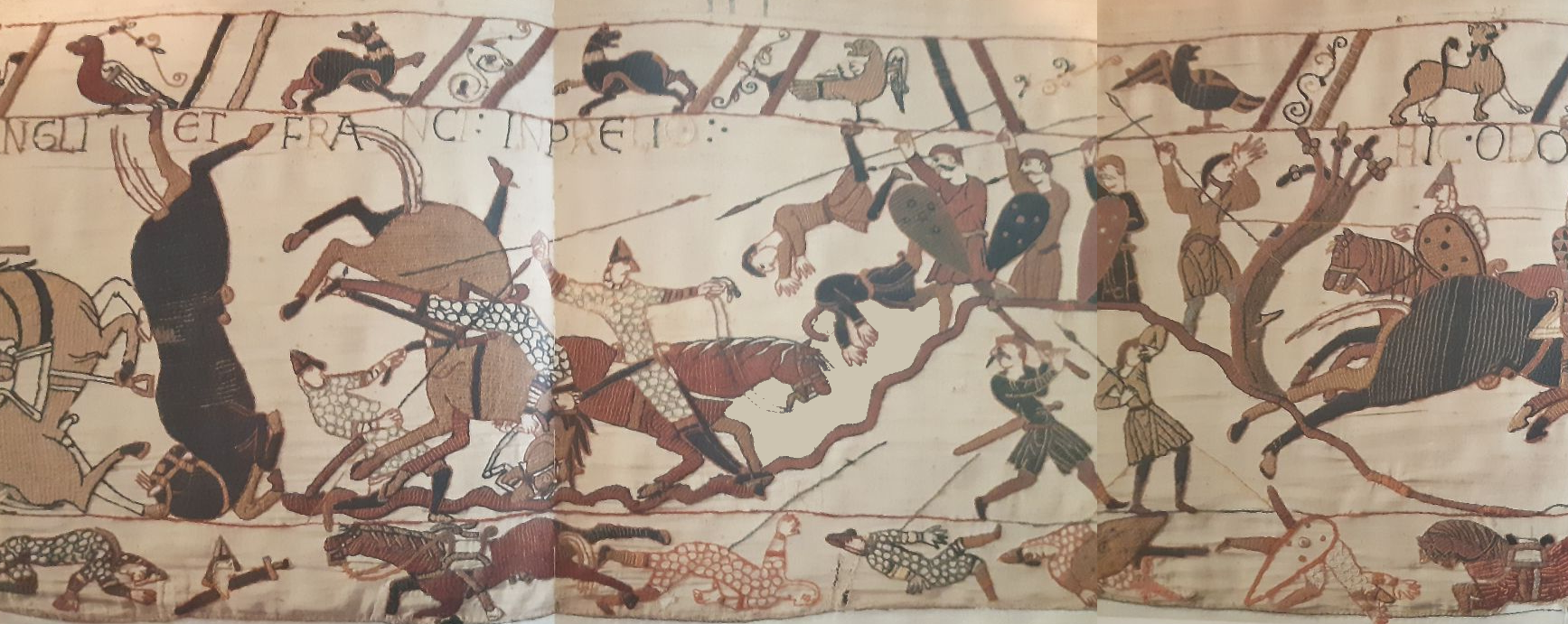
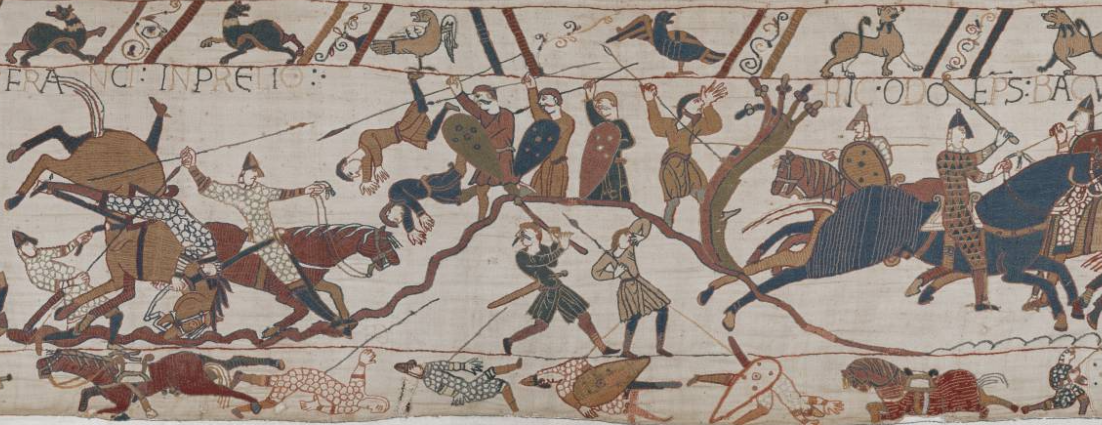
The Bayeux Tapestry
A rough hill is shown but that's all
Battle Abbey Chronicles
- (William) Having arrived at a hill called Hechelande, situated in the direction of Hastings
- Upon the hill where the Abbey now stands, the English supported their king in a compact body
- There lay between the hostile armies a certain dreadful precipice (see our Battle of Hastings 1066AD - U - Evidence for the Battlefield Malfosse)
- The place being marked where the standard of this rash and hostile invasion fell
Master Wace - The Roman de Rou
- till he erected his standard and fixed his gonfanon right where THE ABBEY OF THE BATTLE is now built
- he had the place well examined, and surrounded it by a good fosse, leaving an entrance on each of three sides, which were ordered to be all well guarded. (Battle of Hastings 1066AD - U - Evidence for the Battlefield Malfosse)
- The duke stood on a hill, where he could best see his men
- Harold knew that the Normans would come and attack him hand to hand : so he had early enclosed the field in which he placed his men. (Battle of Hastings 1066AD - U - Evidence for the Battlefield Malfosse)
- They had built up a fence before them with their shields, and with ash and other wood ; and had well joined and wattled in the whole work, so as not to leave even a crevice; and thus they had a barricade in their front, through which any Norman who would attack them must first pass.
- Meanwhile the Normans appeared, advancing over the ridge of a rising ground
- Meanwhile, a fresh company came in sight, covering all the plain
- The youths and common herd of the camp, whose business was not to join in the battle, but to take care of the harness and stores, moved off to wards a rising ground. The priests and the clerks also ascended a hill,
- In the plain was a fosse, which the Normans had now behind them, having passed it in the fight with out regarding it. But the English charged and drove the Normans before them, till they made them fall back upon this fosse, overthrowing into it horses and men. (Battle of Hastings 1066AD - U - Evidence for the Battlefield Malfosse)
- the combatants are many, the plain wide
- The English stood firm in their barricades, and shivered the lances, beating them into pieces with their bills and maces. The Normans drew their swords and hewed down the barricades, (Battle of Hastings 1066AD - U - Evidence for the Battlefield Malfosse)
- The English fell back upon a rising ground, and the Normans followed them across the valley,
- The press was great to cross the bridge, and the river beneath it was deep ; so that the bridge broke under the throng, and many fell into the water. (Battle of Hastings 1066AD - Y - A Bridge Collapses after the Battle)
The Carmen of Guy d'Amiens
- Where he advances(Harold) there he lays planks of wood
And by this means makes dry crossings of rivers
- And the woods full of gleaming weapons
Suddenly a company of English emerged from the forest
And the column rushed from wooded cover
Nearby was a wooded hill, neighbouring the valley
Its terrain was rugged and uncultivated
The English as is their custom advancing crowded together
The king ascended the summit that he might wage war in the midst of his army
At the summit of the hill a streaming banner was planted
The Duke below fearing mastery from the height checks the advancing column
And boldly approaches the steep slope
- They gather in tight formation to charge the slope for slaughter
- The sea is behind back by sea is the way to return
- When the duke spies the king above on the steep hill
His hard pressed men are being torn to pieces
- And so carried with him, returned to his seaside camp
Swearing it better Harold was buried promptly on the coast of the port under a heap of stones
-
Therefore just as he had vowed high on a cliff
He ordered the body entombed on the ground at the summit.
That he may remain sentry over sea and strand
Florence of Worcester
Henry of Huntingdon
Orderic Vitalis
- the English troops, assembled from all parts of the neighbourhood, took post at a place which was anciently called Senlac.(Battle of Hastings 1066AD Location - 3 Senlac where is it and what does it mean ?)
- The battle commenced at the third hour of the ides [14th] of October, and was fought desperately the whole day, with the loss of many thousand men on both sides.
- So the Battle raged from the third hour and Harold the King was killed in the first assault.(Harold death conflicts with other Chronicles)
- Various were the fortunes which attended their retreat ; some recovering their horses, some on foot, attempted to escape by the highways ; more sought to save themselves by striking across the country
- for, galloping onward in hot pursuit, they fell unawares, horses and armour, into an ancient trench, overgrown and concealed by rank grass, and men in their armour and horses rolling over each other, were crushed and smothered. (Battle of Hastings 1066AD - U - Evidence for the Battlefield Malfosse)
| Landscape Features affecting the Site of the Battle ▲ |
|---|
If we use all the above factors from the Chronicles then the following features are recorded.
key to the abbreviations below
- BT (Bayeux Tapestry)
- BC (Chronicles of Battle Abbey)
- MW (Master Wace)
- CAR (The Carmen of Guy d'Amiens)
- FW (Florence of Worcester)
- HH (Henry of Huntingdon)
- OV (Orderic Vitalis)
| 1. The Haran Apuldran (Hoar Apple tree ?? ASC) ▲ |
|---|
This is described in the Anglo Saxon Chronicles as the mustering point for Harold.
'Cotton Tiberius B.iv' in Anglo Saxon
Þis wearð þa Harolde cynge gecydd,
he gaderade þa mycelne here,
com him togenes æt þære haran apuldran,
Wyllelm him com ongean on unwær, ær þis folc gefylced wære.
This is the original translation by the Reverend James Ingram (London, 1823)
This was then told to King Harold;
and he gathered a large force,
and came to meet him at the estuary of Appledore.(I believe this would read apuldre ora in Anglo Saxon)
William, however, came against him unawares, ere his army was collected;
However there are a number of other possible translations please see our Hoar Apple Tree page, also it would seem likely that this was near North Down at Heathfield.
| 2. The Saxons were near a forest (CAR,BT) ▲ |
|---|
This is only found in the Carmen, but worth taking into account as the The Great Oak Forest of Andredsweald was in the area.
The Carmen of Guy d'Amiens
And the woods full of gleaming weapons
Suddenly a company of English emerged from the forest
And the column rushed from wooded cover
Through cover and hiding places in the dense forest
The Bayeux Tapestry
There are a number of trees shown in the Bayeux implying a wooded or forested area.
| 3. Harold ascended a hill (CAR) ▲ |
|---|
|
The Carmen of Guy d'Amiens
"The king ascended the summit that he might wage war in the midst of his army."
This passage indicates that Harold actively climbed to the top of a hill to take his position for battle. The use of "ascended" suggests deliberate movement upward to gain the tactical advantage of height. By positioning himself "at the summit," Harold could oversee his entire army and command from the high ground. This was standard tactical practice in medieval warfare - the defensive force would seek elevated terrain to negate the advantage of cavalry and make infantry charges more difficult.
The Carmen's description also implies that Harold chose this position after surveying the terrain, rather than simply being found there by William's forces. This suggests tactical forethought in selecting the battlefield location.
| | |
|---|
4. The Saxons were on a hill (CAR,BAC,MW,BT) ▲ |
|---|
Battle Abbey Chronicles
Having arrived at a hill called Hechelande, situated in the direction of Hastings
Upon the hill where the Abbey now stands, the English supported their king in a compact body
The Carmen of Guy d'Amiens
The king ascended the summit that he might wage war in the midst of his army.
At the summit of the hill a streaming banner was planted
The Duke below fearing mastery from the height checks the advancing column
And boldly approaches the steep slope
They gather in tight formation to charge the slope for slaughter
Master Wace - The Roman de Rou
till he erected his standard and fixed his gonfanon right where THE ABBEY OF THE BATTLE is now built
The Bayeux Tapestry
| 5. The Saxons were on a level ground (HH) ▲ |
|---|
|
Henry of Huntingdon
"The king [Harold] hastened southwards to oppose him, and drew up his army on level ground in that neighbourhood."
This description appears to contradict other chronicles which place the Saxon army on a hill. However, "level ground" in this context may refer to the flat top or plateau of a hill rather than low-lying terrain. Many of the proposed battlefield sites feature hills with relatively flat summits where an army could form up in ranks.
Alternatively, Henry of Huntingdon (writing in the 1120s-1130s, some 60+ years after the battle) may have received information emphasizing that the Saxon position, while elevated, provided a level fighting surface suitable for forming the shield wall. The apparent contradiction with other sources may reflect different aspects of the same topography - a hill with a level top or a ridge.
It's also worth noting that Henry of Huntingdon was not an eyewitness and was writing from Huntingdonshire, far from the battlefield. His account may reflect garbled or simplified geographical information.
| | |
|---|
6. The Saxons fortify their position (OV,MW,HH,FW,BA,BT) ▲ |
|---|
William of Jumièges
However confidence returned to the fugitives when they found a good chance to renew the battle, thanks to a broken rampart and labyrinth of ditches.
Orderic Vitalis
(The Normans, finding the English completely routed, pursued them vigorously all Sunday night, but not without suffering a great loss ; for, galloping onward in hot pursuit, they fell unawares, horses and armour, into an ancient trench, overgrown and concealed by rank grass, and men in their armour and horses rolling over each other, were crushed and smothered.
Master Wace
and they had moreover made a fosse, which went across the field,
There he said he would defend himself against whoever should seek him ; and he had the place well examined, and surrounded it by a good fosse, leaving an entrance on each of three sides, which were ordered to be all well guarded.
And now might be heard the loud clang and cry of battle, and the clashing of lances. The English stood firm in their barricades, and shivered the lances, beating them into pieces with their bills and maces. The Normans drew their swords and hewed down the barricades, and the English in great trouble fell back upon their standard, where were collected the maimed and wounded.
Henry of Huntingdon
But Harold had formed his whole army in close column, making a rampart that the Normans could not penetrate. Duke William therefore commanded his troops to make a feigned retreat. In their flight they they happened unawares of a deep trench which was treacherously covered into which numbers fell and perished. While the English were engaged in pursuit, the main body of the Normans broke the centre of the enemy's line, which being perceived by those in pursuit over the concealed trench, when they were consequently recalled most of them fell there.
Florence of Worcester
before a third of his army was in fighting order. He gave them battle at a place nine miles from Hastings, where they had built a fort. The English being crowded in a confined position.
The Chronicles of Battle Abbey
here lay between the hostile armies a certain dreadful precipice, caused either by a natural chasm of the earth, or by some convulsion of the elements. It was of considerable extent, and being overgrown with bushes or brambles was not very easily seen, and great numbers of men — principally Normans in pursuit of the English — were suffocated in it
The Bayeux Tapestry
has a scene where horses are seen vertically and a very rough piece of ground goes up to the Saxon positions, this could also be interpreted as a ditch in front of the Saxon lines with men and horses falling into it. A further interesting part of this image is that the legs of the Saxons at the top of the hill are behind the hilltop which could be interpreted as defensive shieldwall above the fosse. (see below)
| 7. The terrain was rugged and uncultivated (BT,CAR) ▲ |
|---|
|
The Carmen of Guy d'Amiens
"Nearby was a wooded hill, neighbouring the valley. Its terrain was rugged and uncultivated"
The Bayeux Tapestry
The tapestry depicts rough, uneven ground with the Saxon position shown on elevated, broken terrain.
The description of "rugged and uncultivated" terrain is significant for several reasons. First, it suggests the battlefield was not on agricultural land but rather on rough pasture, heath, or partially wooded ground - consistent with the edge of the great forest of Andredsweald. Second, "rugged" implies uneven, difficult ground that would further disadvantage Norman cavalry attempting to charge uphill.
This uncultivated character would explain the lack of archaeological evidence - if the land was rough pasture in 1066, it may have remained uncultivated and been subject to minimal plowing, which would have disturbed and scattered any battle debris. Conversely, the current site at Battle Abbey sits on land that was clearly valuable enough to build a major abbey, suggesting it may have been more cultivated than the Carmen's description implies.
| | |
|---|
8. The area was called Senlac (OV) ▲ |
|---|
Orderic Vitalis
the English troops, assembled from all parts of the neighbourhood, took post at a place which was anciently called Senlac.
For further details please look at our Senlac hill page.
| 9. The Battlefield was quite wide and not restricted (MW) ▲ |
|---|
|
Master Wace - The Roman de Rou
"One flies, another pursues swiftly: the combatants are many, the plain wide, the battle and the melee fierce."
Wace's description of "the plain wide" indicates that the battlefield was not confined to a narrow ridge or restricted space, but rather had sufficient breadth to accommodate large-scale maneuvers. This is significant because:
- Both armies numbered in the thousands (estimates range from 7,000-15,000 per side)
- The Norman cavalry needed space to deploy and maneuver in squadron formations
- The Saxon shield wall was formed across a broad front
- Pursuit and flight, as described, required open ground
This contradicts the idea of the battle being fought on a narrow ridge or confined hilltop. Any proposed battlefield site must include sufficient width to accommodate two large armies in formation with room for cavalry maneuver. The use of "plain" (even if elevated) suggests relatively open terrain rather than heavily broken or wooded ground, though this may somewhat contradict the "rugged" description from the Carmen.
| | |
|---|
10. The Battle was 9 miles from Hastings (FW) ▲ |
|---|
|
Florence of Worcester
"he gave them battle at a place nine miles from Hastings"
This is one of the most specific geographical measurements provided in any chronicle. Florence of Worcester, writing around 1118 (approximately 52 years after the battle), states clearly that the battlefield was nine miles from Hastings.
However, several questions arise:
- Nine miles from where in Hastings? The town center, the castle, the port, the Norman camp?
- Was this nine miles by road or as the crow flies?
- How accurate were distance measurements in the 11th/12th century?
- Did Florence have direct knowledge or was he relying on earlier sources?
The traditional Battle Abbey site is approximately 6-7 miles from Hastings town center, which has led some researchers to propose alternative sites further north that better fit the nine-mile measurement. However, if measured from the Norman coastal camp (possibly at Bulverhythe, Bexhill, or Pevensey), the distances change considerably.
Medieval miles were not standardized and could vary from approximately 1.1 to 1.5 modern statute miles, adding further uncertainty. Nevertheless, this measurement remains an important constraint on proposed battlefield locations.
| | |
|---|
11. The Norman camp was at the seaside (CAR) ▲ |
|---|
|
The Carmen of Guy d'Amiens
"He gathered the torn-apart body of Harold,
Gathered, he covered it with purple linen,
and carried it with him, returning to his coastal camp.
The sea is behind, back by sea is the way to return"
Kathleen Tyson's translation
"And returned with it to his camp by the shore,"
The Carmen makes clear that William's base camp remained at the coast throughout the battle. After Harold's death, William returned to this "coastal camp" or "camp by the shore" with the king's body. The phrase "the sea is behind, back by sea is the way to return" indicates that the Norman army had the sea at their backs during the battle - their line of retreat and their ships were behind them to the south.
This has several important implications:
- The Norman army marched inland from their coastal base to meet Harold
- William's supply line ran from the coast to the battlefield
- The battlefield must be positioned such that the Norman forces had their backs to the sea (south)
- The distance from coast to battlefield was within one day's march (see section 10)
The location of this coastal camp is debated - candidates include Hastings, Bulverhythe, Bexhill, or the original landing site at Pevensey. William had built fortifications at both Pevensey and Hastings, and the Carmen's reference may indicate which served as the main operational base during the battle.
| | |
|---|
12. The Battle raged from the 3rd Hour (FW,OV) ▲ |
|---|
Orderic Vitalis
The battle commenced at the third hour of the ides [14th] of October, and was fought desperately the whole day, with the loss of many thousand men on both sides.
So the Battle raged from the third hour and Harold the King was killed in the first assault.(Harold death conflicts with other Chronicles)
Florence of Worcester
nevertheless he gave stout resistance from the third hour of the day to nightfall.
| 13. William was initially on a hill (BAC,MW) ▲ |
|---|
Battle Abbey Chronicles
Having arrived at a hill called Hechelande, situated in the direction of Hastings
Master Wace
The duke stood on a hill, where he could best see his men
| 14. The hill William was on was called Hecheland (BAC) ▲ |
|---|
Battle Abbey Chronicles
"Having arrived at a hill called Hechelande, situated in the direction of Hastings"
The Battle Abbey Chronicles name the hill where William positioned himself as "Hecheland" or "Hechelande." This place name has been the subject of considerable research and debate. The name appears to be Old English or Anglo-Norman in origin, but its precise meaning is uncertain.
Possible interpretations of "Hecheland" include:
- "Hæcc-land" - land with a gate or hatch
- "heáge-land" - high land
- "Hecche-land" - land with a hedge or fence
- "hécen-land" - goat land
Significantly, the chronicle states this hill was "situated in the direction of Hastings" - implying it was between the Norman coastal base (at or near Hastings) and the English position. This suggests Hecheland was on the Norman approach route to the battlefield.
No modern place name clearly derives from "Hecheland," which has led researchers to search for locations that fit the topographical description: a hill on the route from Hastings to the battlefield, suitable for William to halt and observe the English position before engaging.
For detailed analysis of possible Hecheland locations, see our dedicated page: Hecheland - where is it?
| | |
|---|
15. The Normans advanced over a ridge (MW) ▲ |
|---|
|
Master Wace - The Roman de Rou
"Meanwhile the Normans appeared, advancing over the ridge of a rising ground"
This suggests that the Norman army approached the Saxon position by coming over a ridge or crest of higher ground. This would mean William's forces were not simply advancing across flat terrain, but had to cross elevated ground before engaging with Harold's army. This topographical feature would have been visible to observers and would have affected the tactical deployment of both armies.
| | |
|---|
16. Behind the Normans was another hill (MW) ▲ |
|---|
|
Master Wace - The Roman de Rou
"The youths and common herd of the camp, whose business was not to join in the battle, but to take care of the harness and stores, moved off towards a rising ground. The priests and the clerks also ascended a hill"
This indicates that behind the Norman battle lines, there was elevated ground where non-combatants (camp followers, priests, and clerks) gathered to observe the battle. This hill would have been to the rear of William's position, providing a safe vantage point for those not directly engaged in fighting. Any proposed battlefield site should include such a feature behind the Norman lines.
s deep; so that the bridge broke under the throng, and many fell into the water"
| 17. There was a fosse between the forces (MW, HH, FW) ▲ |
|---|
|
Master Wace - The Roman de Rou
"and they had moreover made a fosse, which went across the field"
"There he said he would defend himself against whoever should seek him; and he had the place well examined, and surrounded it by a good fosse, leaving an entrance on each of three sides, which were ordered to be all well guarded"
Henry of Huntingdon
"In their flight they happened unawares on a deep trench, which was treacherously covered, into which numbers fell and perished"
Florence of Worcester
"He gave them battle at a place nine miles from Hastings, where they had built a fort. The English being crowded in a confined position"
Multiple chronicles reference fortifications, ditches, or fosses. Master Wace describes Harold having the position "surrounded by a good fosse" with three guarded entrances. Henry of Huntingdon mentions a "deep trench, which was treacherously covered" that caused Norman casualties during pursuit. Florence references the English having "built a fort" at the location. This suggests the Saxon position included defensive earthworks, either pre-existing or hastily constructed. For more details on this feature, see our Evidence for the Malfosse page.
| | |
|---|
18. There was a steep slope up to the Saxons (CAR) ▲ |
|---|
|
The Carmen of Guy d'Amiens
"The Duke below fearing mastery from the height checks the advancing column. And boldly approaches the steep slope. They gather in tight formation to charge the slope for slaughter"
The Carmen explicitly describes William's forces having to charge uphill to reach the Saxon position. The duke is described as being "below" the English position, and the Normans must "charge the slope" to engage the enemy. This indicates significant elevation change between the two armies' positions, with the gradient steep enough to be tactically significant. The Norman cavalry would have been at a considerable disadvantage charging uphill against a defensive shield wall.
| | |
|---|
19. Behind the Saxons was another hill (MW) ▲ |
|---|
|
Master Wace - The Roman de Rou
"The English fell back upon a rising ground, and the Normans followed them across the valley"
This passage describes the English retreat during the later stages of the battle. The fleeing Saxons withdrew to "a rising ground" behind their original position, with the pursuing Normans following them "across the valley." This suggests that behind Harold's main battle line, there was lower ground (a valley) and then another hill or elevated area to which the routed English retreated. This is separate from the main hill where Harold's standard stood and relates to the geography of the Saxon retreat route.
| | |
|---|
20. The sea was behind the Normans (CAR) ▲ |
|---|
|
The Carmen of Guy d'Amiens
"The sea is behind, back by sea is the way to return"
"And so carried with him, returned to his seaside camp.
Swearing it better Harold was buried promptly on the coast of the port under a heap of stones.
Therefore just as he had vowed high on a cliff.
He ordered the body entombed on the ground at the summit.
That he may remain sentry over sea and strand"
The Carmen makes clear that the Norman army had the sea at their backs - their line of retreat and their camp were both coastal. After the battle, William returned "to his seaside camp" and initially wanted Harold buried "on the coast of the port under a heap of stones" so he would "remain sentry over sea and strand." This indicates the battlefield was positioned such that the Norman forces were between the coast and the English position, with their supply base and ships behind them to the south.
| | |
|---|
21. Fleeing Saxons were killed when a bridge collapsed (MW) ▲ |
|---|
|
Master Wace - The Roman de Rou
"The press was great to cross the bridge, and the river beneath it was deep; so that the bridge broke under the throng, and many fell into the water"
During the English retreat, Wace describes fleeing Saxons attempting to cross a bridge over a deep river. The bridge collapsed under the weight and press of the panicking men, causing many to fall into the water and drown. This indicates that the Saxon line of retreat led toward a river crossing, and that this river was substantial enough to require a bridge and deep enough to be dangerous to men in armor. This is a separate incident from the Malfosse and relates to the geography of the English escape route. For more details see our page on The Bridge that Collapsed During the Retreat.
| | |
|---|
Landscape Features affecting the Site of the Battle - Summary ▲ |
|---|
This paragraph shows a list of the Landscape features
- The Haran Apuldran (Hoar Apple tree ?? ) (ASC)
- The Saxons were near a forest (CAR)
- Harold ascended a hill (CAR)
- The Saxons were on a hill (CAR,BAC,MW,BT,)
- The Saxons were on a level ground (MW)
- The Saxons fortify their position (OV,MW,HH,FW,BA,BT)
- The terrain was rugged and uncultivated (BT,CAR)
- The area was called Senlac (OV)
- The Battlefield was quite wide and not restricted (MW)
- The Battle was 9 miles from Hastings (FW)
- The Norman camp was at the seaside (CAR,FW)
- The Battle raged from the 3rd Hour (FW,OV)
- William was initially on a hill (BAC,MW)
- The hill William was on was called Hecheland (BAC)
- The Normans advanced over a ridge (MW)
- Behind the Normans was another hill (MW)
- There was fosse between the forces (MW,HH,FW)
- There was a steep slope up to the Saxons (CAR)
- Behind the Saxons was another hill (MW)
- The sea was behind the Normans (CAR,MW)
- Fleeing Saxons were killed when a bridge collapsed (MW)
Please Note: the following are the key to the above list
BT (Bayeux Tapestry)
BC (Chronicles of Battle Abbey)
MW (Master Wace)
CAR (The Carmen of Guy d'Amiens)
FW (Florence of Worcester)
HH (Henry of Huntingdon)
OV (Orderic Vitalis)
| Battle times from the Chronicles ▲ |
|---|
Orderic Vitalis writes:
- Battle was joined on 14th October at the third hour and was bitterly contended all day long with heavy slaughter on both sides.
- The Battle raged from the third hour and Harold the King was killed in the first assault.(Harold death conflicts with other Chronicles)
Florence of Worcester writes:
- He gave them battle at a place nine miles from Hastings, where they had built a fort.
- nevertheless he gave stout resistance from the third hour of the day to nightfall.
| Sunrise and Sunset times in October 1066AD ▲ |
|---|
To try to get some idea of possible locations we can try to use the sunrise sunset times that cover this area.
Please be aware that sunrise sunset times vary across every location in the world due to latitude and longitude changes.
Now we can get the modern sunrise/sunset times for Bexhill as this seems to be the probable location of the Norman camp.
So for the 14th October the sunrise/sunset times are 07:19 ->18:07(GMT) this is taken from Time and Date.com
However there is light before sunrise and this was 06:46->18:40(GMT), so there is about 34 minutes before dawn where it is light.
Orderic Vitalis writes:
So the Battle raged from the third hour and Harold the King was killed in the first assault.(Harold death conflicts with other Chronicles)
So this could mean from sunrise or twilight, and so the start was sometime around 9.45 to 10.15(GMT) using modern calculations, however this may have meant it started before the fourth hour of the day.
Let us assume therefore that the possible start of the Battle was between 09:46 to 11:19(GMT), and ended at the end of the day so lets assume about 17:00.
This would make this battle one of the longest Early Medieval battles.
| Map showing possible distances from the Normans coastal base ▲ |
|---|
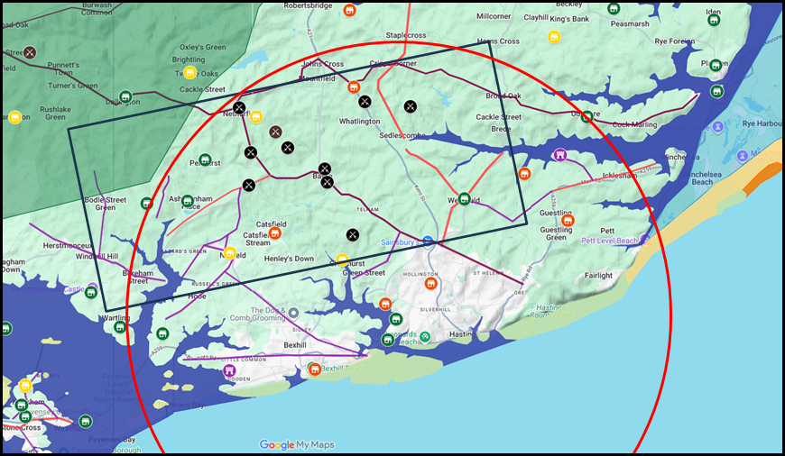
If the start of the Battle was between 09:46 to 11:19(GMT), this would mean that the Normans, allowing 30 minutes to prepare, could have marched at 2.5 mph between 2 and 4 hours from their coastal base, this equates to somewhere between 5 and 9 miles, but could have been less so probably 2 mph to allow for weapons etc that would give 4 miles to a maximum of 8 miles.
The red circle shows a distance of 9 miles from Hastings as per: Florence of Worcester.
The black rectangle shows a 3 hour march from the coast, with a likely minimum distance from the coast of 4 miles (5km) and maximum of 8 miles (12Km)
As you can see this area covers the majority of the suggested sites with the exception of site 1.
|
|
|
|
;)
)
)


