| Landscape - The East Sussex Coastline about 500AD |
|---|
| |
|---|
Map of the Coastline in aproximately 500AD |
|---|
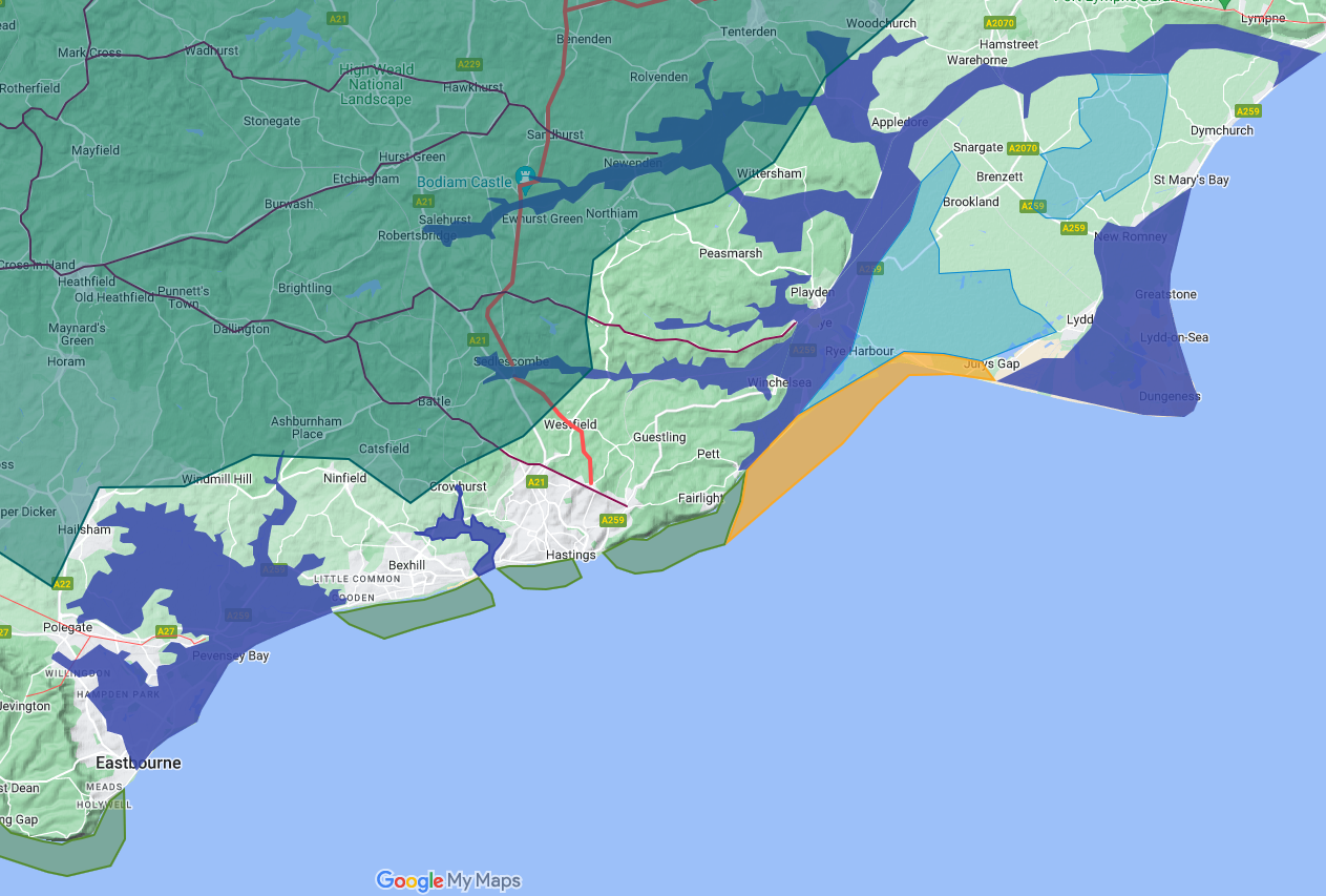
This map shows the East Sussex coastline from Beachy Head to Hythe in Kent at about 500AD.
The blue shaded area shows the sea/high tide level at about 4.5 metres which changes the shape of the coastline. please click the following link for an explanation (~~Sea_levels_and_the_Pevensey_islands~~)
and (~~Sea_Level_Rises~~).
The red lines shows the old Roman military road that runs from Gravesend to Hastings, to allow foot access to the Roman iron workings in Hastings and Sedlescombe.
The maroon lines show the old Celtic Ridge-ways that were re-purposed by the Romans to allow east west travel to and from the London Lewes Roman road.(Roman Roads)
The Roman Forest of Silva Anderida is the area shown shaded in green, please click the following link for an explanation of its identification (~~The_great_oak_forest_of_Andredsweald~~)
The River Rother runs along the northern boundary of the Romney Marsh, please click the following link for an explanation of the changes in the Marshes (~~Romney_Marsh_History~~)
The coast is extended into the Channel using the current erosion rates from Hastings and Beachy Head extrapolated back in time. Please Note: the Filsham valley entrance, and Hastings old town shapes are my estimation.
At the current rates of erosion of 0.5 metres/year at Fairlight and 0.6 metres/year at Eastbourne mean that the coast was about 1.5 km(just under a mile) further out in late Roman/early Saxon times. click the following link for more details (~~the_coast_of_East_Sussex_and_erosion~~)
|
|
|
;)


